U.S. corn and soybean crop: a second cold wave threatens
A 1 cold wave 14 days ago has spread only in 3% of the cultivation areas according to the findings of observers of the harvest. Degrees of cooling to-2 degrees Celsius did little significant damage.
The remaining unusually low temperatures of in recent weeks however delay the maturity. This extends the harvest in the length. The probabilities of occurrence of early frost is getting bigger and thus the risk of the final harvest outcome.
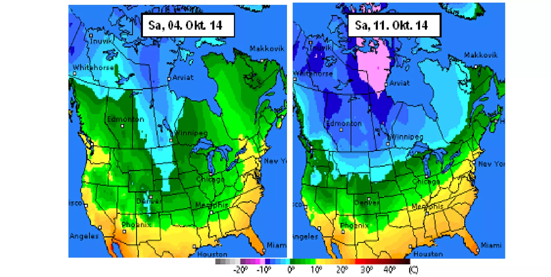
According to the latest weather forecasts, a cold wave in the second week of October looming again. The front comes from Canada, and to the Northern corn and soybean areas of North and South Dakota, as well as northern Wisconsin. The refrigerant levels be assessed after the first projections in the moderate range, so that the degree of damage can remain manageable.
However, weather forecasts with caution are to be interpreted. Canada's large Prairies are already firmly in the grip of winter with temperatures between - 5 to - 10 degrees Celsius. Extent to which the thrust force of the cold front in the States into enough can be predicted only with large uncertainty factors.
On the stock markets, the recent weather conditions have found little precipitation. It is Very much engaged in the valuation of low forward rates, which fit to the still higher expectations of harvest. It is possible that the mood turns a little in the coming trading week and amplified risk premia in the courses are priced.

